
The Fishermen's Trail (also spelt Fisherman's Trail) is the coastal hiking path of the Rota Vicentina in Portugal. It follows the cliffs and beaches of the southwest coast, on paths the local fishermen used to reach the sea. Four of its stages run close to our guesthouse – from the wild west coast at Carrapateira, round the corner at Sagres, and along the south coast to Praia da Luz. The Fishermen's Trail is part of the Rota Vicentina – some walkers also call it the Fisherman's Way or Fishermen's Walk.
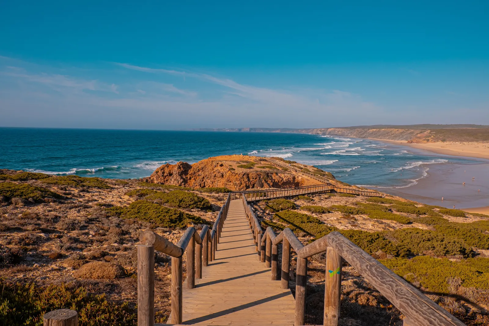
Hiking the Fishermen's Trail – stages near Sagres and Vila do Bispo
Fishermen's Trail map
Tap the buttons to switch layers on and off.
- Monte Loureiro: Our guesthouse – a quiet spot between Vila do Bispo and Raposeira, with pool, barbecue area and shared kitchen. The Gravel & Bikepacking route passes right by the house. For surfers: board storage, drying area and an outdoor sink.
- Carrapateira: Start of the stage to Vila do Bispo.
- Vila do Bispo: Supermarkets and a laundrette. Restaurants: Pisco, Ribeira do Poço, A Eira do Mel.
- Sagres: End of the stage from Vila do Bispo, start towards Salema. Grilled fish: A Sereia above the fish auction at Baleeira harbour, or Retiro do Pescador. Back by Uber.
- Salema: Fishing village between two stages.
- Praia da Luz: End of the stage from Salema. Getting back: pre-book a taxi, bus via Espiche or Lagos, or Uber.
- Bordeira: Small village inland from Praia da Bordeira, quiet and unspoilt.
- Raposeira: Raposeira village.
- Burgau: Fishing village with a beach, cafés and restaurants.
- Budens: Budens village.
- Praia da Bordeira: Our favourite beach – the dunes in front of Praia da Bordeira.
- Praia do Amado: Surf schools, a beach bar and a café – good for a break and water.
- Praia da Ingrina: In winter, check opening beforehand.
- Praia do Zavial: Loose stones on the way down.
- Boca do Rio: Open bay with the ruins of Forte de Almádena. After rain, water can stand at the stream mouth.
- Praia de Burgau:
- Cabo de São Vicente: The far southwest corner of Europe – on the Vila do Bispo – Sagres stage. The classic, at the lighthouse, with a wide view over the Atlantic.
- Carrapateira – Vila do Bispo: 16 km · approx. 6.5 h · difficult. West coast with Praia do Amado and steep climbs along the cliffs.
- Vila do Bispo – Sagres: 20.5 km · approx. 7 h · medium. Our pick for a full walking day – via Cabo de São Vicente.
- Sagres – Salema: 19.5 km · approx. 8 h · very difficult. The hardest stage in the area: down into the coves and back up, again and again.
- Salema – Luz: 12 km · approx. 5 h · medium. Our pick for a shorter day – with Boca do Rio and a break in Burgau.
- Gravel & Bikepacking – Rota Vicentina: The official Rota Vicentina cycling route (gravel & bikepacking). It passes right by our house and ends at Cabo de São Vicente. Some sections are soft sand.
1 Carrapateira – Vila do Bispo · 2 Vila do Bispo – Sagres · 3 Sagres – Salema · 4 Salema – Luz
Numbers = stages in walking direction towards Lagos
Hover over the map or tap a point for more information.
The four Fishermen's Trail stages around us
| Stage | Distance | Walking time | Difficulty | Map |
|---|---|---|---|---|
| Carrapateira – Vila do Bispo | 16 km | approx. 6.5 h | difficult | Map → |
| Vila do Bispo – Sagres | 20.5 km | approx. 7 h | medium | Map → |
| Sagres – Salema | 19.5 km | approx. 8 h | very difficult | Map → |
| Salema – Luz | 12 km | approx. 5 h | medium | Map → |
Source: Turismo do Algarve – portuguesetrails.com
Fishermen's Trail map: stages, beaches and food stops
Our map shows all four stages plus beaches, restaurants, supermarkets and viewpoints along the trail. Go to the map →
One day of hiking: which stage?
For a full walking day we recommend Vila do Bispo – Sagres: open cliffs, Cabo de São Vicente and the end of Europe's southwest corner. For a shorter day, Salema – Luz is our choice – varied, with Boca do Rio and a break in Burgau. Sagres – Salema is the hardest stage in the area; plan it for a day when you have energy to spare.
Where to stay on the Fishermen's Trail: start at the guesthouse
Many of our guests walk from the guesthouse to the trail. In Vila do Bispo the stage starts and ends near the supermarkets, by the Aldi.
Getting back after a stage
There is no shuttle on these stages, but Uber operates here. For some stages a pre-booked taxi or the bus also works – the stage pages have the details.
Best season and safety
The Rota Vicentina recommends walking the Fishermen's Trail between September and June. Much of the path is soft sand and runs close to the cliff edge, so good shoes, water and sun protection matter on every stage. In storms, heavy rain or bad trail conditions, postpone the walk. Check the Rota Vicentina warning map and the weather warnings before you set off. Official information and GPX files: Fishermen's Trail at Rota Vicentina.
Hiking several stages in this area? Our guesthouse between Vila do Bispo and Raposeira is a quiet base to return to each evening.
See rooms for walkersUpdated: October 2026